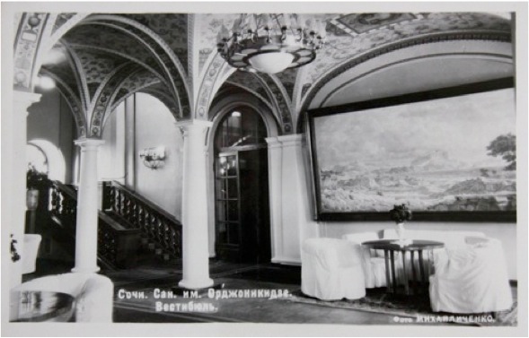
Sochi in Six Dimensions will be based upon current satellite imagery, but will feature a number of additional cartographic layers, such as historical maps and charts of linguistic and ethnographic zones. User control will enable and combine these layers in freeform ways, including the superimposition of one map’s features over another’s so that, for instance, old architecture can be located on a current map. The site will feature several zoom-in locations for which there are especially dense collections of data. These will include two classic Stalinist sanatoria: Metalurg, and Ordzhonikidze, which served Soviet mine workers.

Both maintained archives containing photographs, newspaper clippings, histories of treatment regimes, descriptions of food service, and so forth, all of which will be displayed online. Both have also been selected for redesign and have struggled to define new identities while also honoring their landmark status.

Map users will be able to tour both spaces as they appear today, but also as they looked in their Soviet heydays; they can access building plans, virtually enter the buildings and rooms, see the medical equipment of the time, hear the music that was played, meet the doctors and patients, watch video narratives, and access memoirs and comments in the guest books. It will be possible to learn in detail about treatments such as galvinization.

The public inscription process described below will lead to a map populated with a broad range of objects, from curiosities like Stalin’s dacha or Putin’s yacht, to spaces like the marketplace or boardwalk, to private homes, where one can see and hear the lives of the residents in different eras—their conversations, music, movies, furnishings, and belongings. The result will be a map rich with layers and contiguities, offering new possibilities for interdisciplinary investigation. Social scientists, for instance, who might typically contextualize their explorations in socio-economic or ethnolinguistic zones, will find new nodes of inquiry as these layers of our map overlap with architectural, geo-political, and socio–cultural ones.

Many spaces were renamed after the revolution, then again after the fall of communism, while still other spaces have acquired popular, and sometimes pejorative, names (one building is currently called the Titanic for its overbearing prow-like profile, another the “Great Wall” for its long, tall, and narrow structure). Sochi in Six Dimensions will catalog this diverse network of appellations, and will also trace repurposing: for example, a house of rest, designed by the Vesnin Brothers in 1927, was later incorporated into the Zarya Sanatorium, and has recently been absorbed into an army training complex. The attributes of buildings will be described by data (occupancy, sale prices, amenities, floor plans), as well as by the literature supporting them (sales brochures, advertisements) or contesting them (preservationist arguments against their construction).

Users will also be able to explore selected features such as architectural topography. Obscured sight lines might be indicated, so that the social cost of tall buildings can be considered, but more generally the mapping will demonstrate the shift from the more horizontal planning of the Soviet version of the city to the vertical emphasis of the new construction. In the former, clusters of sanatoria were situated as ensembles, with shared paths and a coherent plan of access to cultural and recreational facilities; the architecture blended into the hills and trees, and care was taken to preserve sight lines. This layout conformed to the social architecture it reflected, in which the space was to be made available to the average worker.

The new model, by contrast, reflects a much more vertical socio-economic structure, in which high-rises are accessible only to the highly affluent. Current advertisement culture can be compared to propaganda from the Soviet period to quickly orient the visitor to this fundamental revision of the city.

A search engine will link users to specific sites on the map. This might be done by naming the location itself (“Metalurg Sanatorium”) or by referencing some other associated entity. Users might seek buildings designed by certain architects or of certain vintage. They might tour the buildings that were used as military hospitals in World War II or those destroyed during the recent reconstruction. They can explore how green space has been managed, and how railways and roads have divided the territory of Greater Sochi. It will also be possible to search by historical events: in what year did Van Cliburn perform in the city, and where did the concert take place? Visitors to a certain hotel or sanatorium might even encounter other guests that they met on a vacation many years ago, either by identifying them in pictures or by finding their name on a posting.
Public Inscription


